Countries

POLAND
About us
We come from a small town in the northern part of Poland. The history of Chojnice dates back 700 years ago.
Chojnice belonged to monastic order for 150 years. The Teutonic Knights had the habit of fortifying strategic cities and all the places they hosted.
Gothic buildings of red brick, remains of medieval defensive walls. In 1466, a battle near Chojnice took place. Thanks to it, the whole Pomeranian regions were joined to the Kingdom of Poland.
Chojnice was a small but important town. The remains of medieval architecture is still visible: gates, towers, walls. The town was located in the center of the monastic state at the crossroads of trade routes. Merchants travelling from the March of Brandenburg to Malbork and from Toruń to Gdańsk had to follow this way.
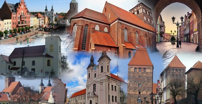
A virtual walk through the historic part of Chojnice
Our country
Poland (Republic of Poland) is located in Central Europe. The area of our country is 312,696 square kilometres and it is divided into 16 voivodeships. With a population of nearly 40 million people, we are the ninth most populous country in Europe.
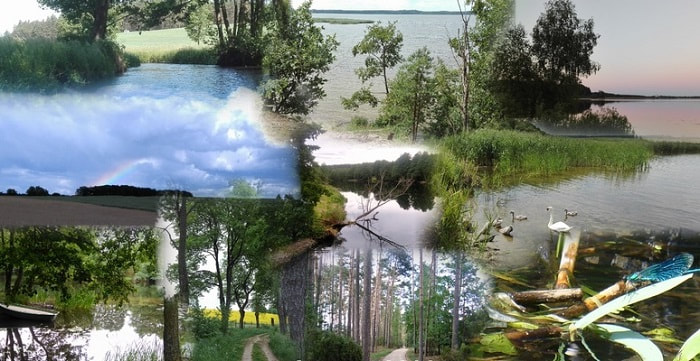
Poland is a really nice place to visit. In the north we border with the Baltic Sea. There are many beautiful beaches, bays and cliffs. Moving a bit to the east we will come across a beautiful region called Masuria (in polish, Mazury). It is the land of the lakes. There are about 2600! Śniardwy, with the surface of 113.8 square kilometres, is the biggest one. Then, in south, there are many mountain ranges like Góry Świętokrzyskie, Beskidy, Bieszczady, and last but not the least, Karpaty (especially the part called Tatry).
The capital city of Poland is Warsaw. With almost 1.8 residents, it is the largest city. Through Warsaw flows the most popular river — Vistula. There are a lot of interesting monuments such as Pałac Kultury i Nauki, Łazienki and many more.
Our flag is simple, but very meaningful. The white part symbolizes silver, as well as water and purity. Red is a symbol of fire and it means courage and bravery.
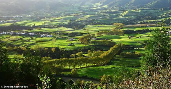
Our region
Our region is famous for lakes and forests which we have plenty of around. Owing to that water sports are prevailing here, expecially during the summer season. Another advantage of our region is the development of infrastructure for tourism and doing sports. Over the last years, many kilometers of cycle lanes have been built, which now enable locals to travel by bike from one village to another without using the roads. It definitely improved safety on the roads, but also it activated the society in the region. These days, it is more and more common to see people jogging, riding a bike, rollerskating, etc. Moreover, Poland is now experiencing a craze for healthy lifestyle, so there are many people now who attend the gym on regular basis.
Our region is famous for lakes and forests which we have plenty of around. Owing to that water sports are prevailing here, expecially during the summer season. Another advantage of our region is the development of infrastructure for tourism and doing sports. Over the last years, many kilometers of cycle lanes have been built, which now enable locals to travel by bike from one village to another without using the roads. It definitely improved safety on the roads, but also it activated the society in the region. These days, it is more and more common to see people jogging, riding a bike, rollerskating, etc. Moreover, Poland is now experiencing a craze for healthy lifestyle, so there are many people now who attend the gym on regular basis.
Our school
Our school, in fact, forms a community of schools on all levels of education ranging from the nursery to the high school. Catholic High School counts 70 students, 15 teachers and 5 non-teaching staff. Students are aged 15-19. They are preparing here to undertake studies at universities.
The school day begins at 8:00 and ends at 14:40. Later, pupils can choose various activities: Dance Club, Drama Club, School Sport Club or Choir. Main subjects are: Polish, Math, History, Geography, Science Subjects (Physics, Biology, Chemistry) Music, PE, Informatics. From the second grade students attend extra classes to prepare for the final exams which they have chosen.
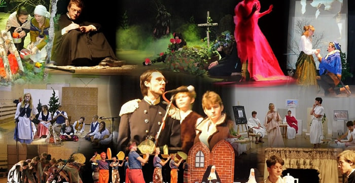
Our extra activities: Day of Foreign Languages, Humanities Day, Day of Science Mathematics and Natural Sciences, Family Fest, Open Door Day, the First Day of Spring, Erasmus+ Festival. Students actively participate in drama classes and prepare the end of the year show staged for the local community based on important historical events.
Our school, in fact, forms a community of schools on all levels of education ranging from the nursery to the high school. Catholic High School counts 70 students, 15 teachers and 5 non-teaching staff. Students are aged 15-19. They are preparing here to undertake studies at universities.
The school day begins at 8:00 and ends at 14:40. Later, pupils can choose various activities: Dance Club, Drama Club, School Sport Club or Choir. Main subjects are: Polish, Math, History, Geography, Science Subjects (Physics, Biology, Chemistry) Music, PE, Informatics. From the second grade students attend extra classes to prepare for the final exams which they have chosen.
Our extra activities: Day of Foreign Languages, Humanities Day, Day of Science Mathematics and Natural Sciences, Family Fest, Open Door Day, the First Day of Spring, Erasmus+ Festival. Students actively participate in drama classes and prepare the end of the year show staged for the local community based on important historical events.


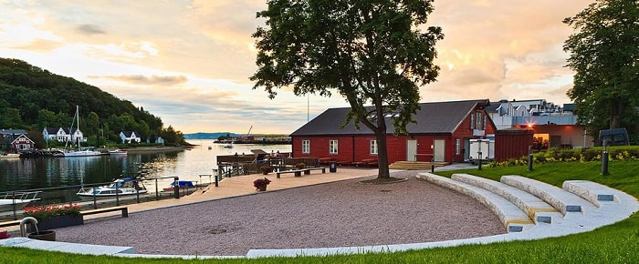
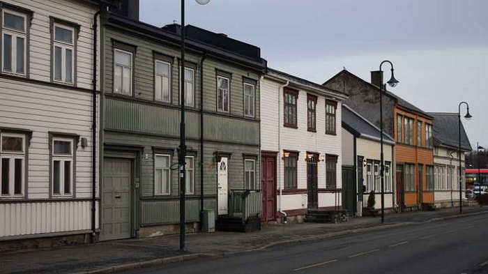
NORWAY
Our city
Levanger is a municipality with a small city centre near Trondheim fjord, in the middle of Norway. There are about 17 000 inhabitants in the municipality.
Levanger is a municipality with a small city centre near Trondheim fjord, in the middle of Norway. There are about 17 000 inhabitants in the municipality.
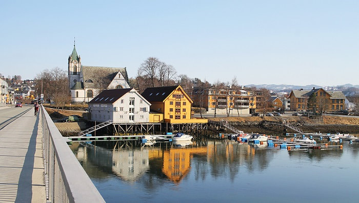
In 2018, large parts of Levanger city centre were protected as a cultural environment. The listing includes the city’s streets and squares, green areas and buildings with its backyards.
Some major industries in our region are the paper factory "Norske Skog" and a construction plant producing platforms for the North Sea. Levanger also has a hospital and a university campus.
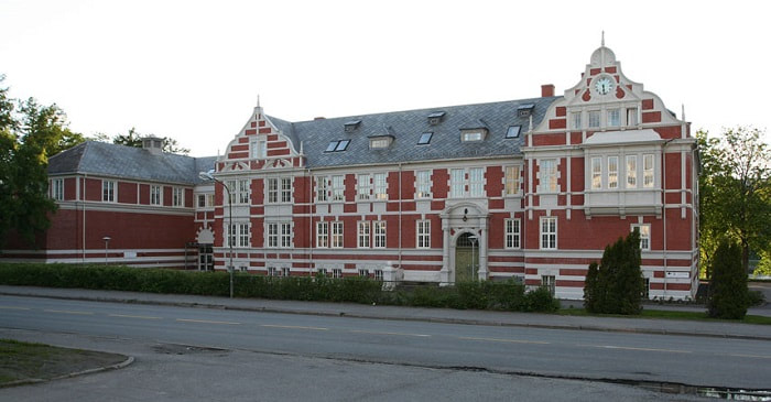
Our School
Levanger videregående skole is an Upper Secondary School with around 800 students and 200 employees. We have both general and vocational studies.
The vocational programmes include Electricity and Electronics, Health Care, Childhood and Youth Development, Restaurant and Food Processing, and Technical and Industrial Production.

ITALY
Sardinia
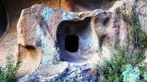
Though geologically very ancient, it was only in the Neolithic period, in the late Stone Age, that people arrived in Sardinia from the East. They lived on fishing and hunting, obtained the tools they needed for their activities from splinters of volcanic rock called obsidian and used clay to make simple earthenware pots. The first settlements were near the coast and from there the first inhabitants moved towards inland areas where they started stock-raising and agriculture. They worshipped the mother goddess and the bull-god, symbols of fertility, they also practiced the cult of the dead, who were placed in small caves hollowed out of the rock called domus de janas (fairies’ houses).
Though geologically very ancient, it was only in the Neolithic period, in the late Stone Age, that people arrived in Sardinia from the East. They lived on fishing and hunting, obtained the tools they needed for their activities from splinters of volcanic rock called obsidian and used clay to make simple earthenware pots. The first settlements were near the coast and from there the first inhabitants moved towards inland areas where they started stock-raising and agriculture. They worshipped the mother goddess and the bull-god, symbols of fertility, they also practiced the cult of the dead, who were placed in small caves hollowed out of the rock called domus de janas (fairies’ houses).
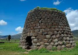
About halfway through the second millennium B.C. other people arrived in Sardinia from the East and built with huge blocks of stones in megalithic style, those magnificent, truncated towers called Nuraghi in high places, each one in view of another.
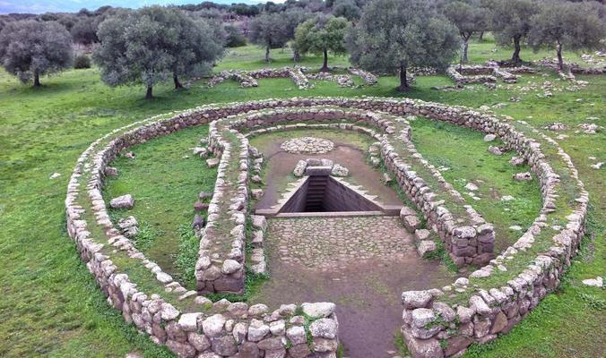
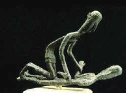
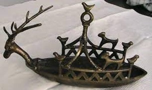
The Nuragic people practised the cult of spring-water in the temple a pozzo (well temples) and worshipped their ancestors in the tombe dei giganti (giants’ tombs), offering vivid little bronze statues representing men, animals, small craft, and totem to their divinities.
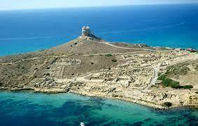
After the year 1000 B.C. the Phoenicians arrived in the island and founded some cities on the sea along the south-west coast, to support their trade-routes, carrying on their peaceful policy of exchange goods with the natives. The most important places under this Phoenician influence were Nora, Karalis, Sulci, Tharros, Bithia, and Cornus.
Towards the end of the sixth century B.C., Sardinia was invaded by the Punics from Carthage, who were the African Phoenicians. They occupied the whole island fighting bitter battles with the Nuragic tribes who retreated to the mountainous interior. The Punic imposed their Semitic religion with its cruel sacrificial rites on the natives, increased agriculture to produce cereals and taught their technique of tunny-fishing and salt-mining, besides intensively exploiting mineral and metal resources.
The Romans occupied Sardinia after the second Punic War in 264 B.C., under Roman rule Christianity was introduced but did not reach every part of the island. With the decline of the West Roman Empire, Sardinia was progressively abandoned and was for 80 years under the Vandals driven away by the Byzantines who took possession in the name of the Oriental Roman Empire with Giustiniano in 534. The Byzantines were greedy and predatory thinking only on getting their hands on all properties and riches and neglecting the island which underwent many Arab incursions. The coastal population, fearing the violence of the pirate raids fled to the interior and Sardinia was conquered again by the new invaders led by Mugahid, known as Museto. Sardinians fought to defend their liberty and taking advantage of the Byzantine neglect, achieved independence under four self-governing kingdoms called Giudicati. The Giudici were the representatives of the Byzantine Emperor that made themselves independent around the year 1000. The four Giudicati were: the Giudicato of Cagliari, giudicato of Arborea, Giudicato of Logudoro, and Giudicato of Gallura. During this period, Sardinia flourished, but very soon, with the intervention of the Church the two strong marine republic of Pisa and Genua set foot in the island, and on the pretext of helping the Giudici to defend themselves against the Arab raids, they took over the whole territory, also taking advantage of local disagreements and rivalries. Pisa got the upper hand in the South, while Genua dominated the North. The period of the Giudicati was productive for Sardinia: the economy expanded thanks to the mercantile traffic, there was a religious revival, a spreading of art, and a body of concrete and practical laws which disciplined life and civil relations was made.
The Romans occupied Sardinia after the second Punic War in 264 B.C., under Roman rule Christianity was introduced but did not reach every part of the island. With the decline of the West Roman Empire, Sardinia was progressively abandoned and was for 80 years under the Vandals driven away by the Byzantines who took possession in the name of the Oriental Roman Empire with Giustiniano in 534. The Byzantines were greedy and predatory thinking only on getting their hands on all properties and riches and neglecting the island which underwent many Arab incursions. The coastal population, fearing the violence of the pirate raids fled to the interior and Sardinia was conquered again by the new invaders led by Mugahid, known as Museto. Sardinians fought to defend their liberty and taking advantage of the Byzantine neglect, achieved independence under four self-governing kingdoms called Giudicati. The Giudici were the representatives of the Byzantine Emperor that made themselves independent around the year 1000. The four Giudicati were: the Giudicato of Cagliari, giudicato of Arborea, Giudicato of Logudoro, and Giudicato of Gallura. During this period, Sardinia flourished, but very soon, with the intervention of the Church the two strong marine republic of Pisa and Genua set foot in the island, and on the pretext of helping the Giudici to defend themselves against the Arab raids, they took over the whole territory, also taking advantage of local disagreements and rivalries. Pisa got the upper hand in the South, while Genua dominated the North. The period of the Giudicati was productive for Sardinia: the economy expanded thanks to the mercantile traffic, there was a religious revival, a spreading of art, and a body of concrete and practical laws which disciplined life and civil relations was made.
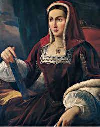
The Giudicato of Arborea was particularly brilliant under Mariano and his daughter, the great Eleonora succeeding in promulgating the Carta de Logu, a code of laws suited to the needs of the population. Towards the end of the XIIth century, Pisa obtained complete supremacy over the island and reached stability of economic and political conditions, but Pope Boniface VIII gave Sardinia in feud to the kings of Aragon in 1297, thus in 1323 the Infante Don Alfonso landed with an army in Cagliari to make official the acquisition of Sardinia in favour of James II of Aragon in the ‘Regnum Sardiniae et Corsicae’. The Aragons found a strong opposition in the Pisan and Genua families of Doria and Malaspina and in the GIudicato of Arborea which was defeated after a long war in 1410. First the Catalan-Aragon and then the Spanish established a colonial rule in Sardinia, they exploited the island’s resources to the utmost, especially through feudal benefits controlled by a Spanish Viceroy in Cagliari, aided in his work of plunder by an entourage of Spanish civil servants. Under Spain the population of the island decreased to 80.000 people, agriculture and stock-raising deteriorated, the oppression of the Barons got worse, malaria increased and there were no important cultural events. These dramatic conditions evolved toward the end of the XVIIth century when Sardinians were allowed to hold public office, the universities of Cagliari and Sassari were founded, and agriculture prospered once more. In 1713, the Treaty of Utrecht assigned Sardinia to Austria, but a few years later it was exchanged with Sicily and given to the Duke of Savoy who acquired the title of king of Sardinia. For about two centuries the island was left in a wretched state of abandon and once more exploited, it was deprived of its forests which were sold to enterprises in Tuscany by Count Cavour and the mines were given in concession to be worked by foreign industries.
In the first half of this century, the desire of self-government flared up again because of the serious economic situation, the injustices of bad government and the deficiencies of the centralizing state. After World War One, the members of Sardinian fighting forces, united in the Sardinian Action Party, organized a dynamic, political movement demanding a material and cultural reform in Sardinia. The Fascist dictatorship brought new land under cultivation in Arborea and Fertilia and completed the building of the dams on the rivers Tirso and Coghinas, creating huge water reservoirs for civil and agricultural use in the dry months. After World War Two, in 1948 the regional council opted and obtained the Statute of Self-Government. In 1997 the Region Sardinia passed a law that finally gave Sardinian language the same official dignity as Italian. Now it is possible to write legal documents, broadcast programs, teach Sardinian at school, and use it as a live language while before that law it was illegal.
In the first half of this century, the desire of self-government flared up again because of the serious economic situation, the injustices of bad government and the deficiencies of the centralizing state. After World War One, the members of Sardinian fighting forces, united in the Sardinian Action Party, organized a dynamic, political movement demanding a material and cultural reform in Sardinia. The Fascist dictatorship brought new land under cultivation in Arborea and Fertilia and completed the building of the dams on the rivers Tirso and Coghinas, creating huge water reservoirs for civil and agricultural use in the dry months. After World War Two, in 1948 the regional council opted and obtained the Statute of Self-Government. In 1997 the Region Sardinia passed a law that finally gave Sardinian language the same official dignity as Italian. Now it is possible to write legal documents, broadcast programs, teach Sardinian at school, and use it as a live language while before that law it was illegal.
Our School
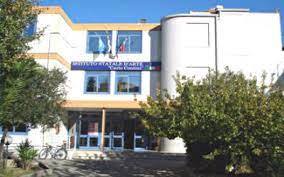
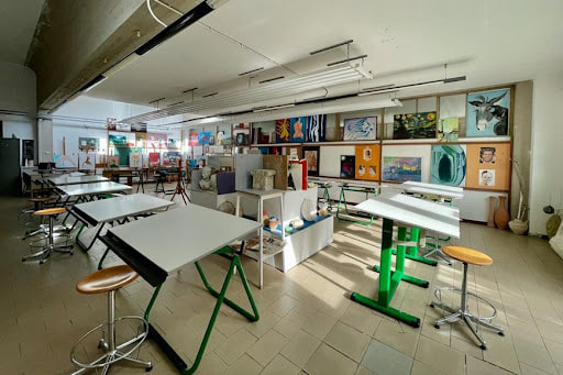
The Liceo Artistico ‘Carlo Contini’, is an upper secondary school, in the urban area of Oristano. The school was founded in 1961 to build up theold and rich tradition of pottery making in Oristano. Since then, it has changed the status of vocational school to that of Liceo in 2010. Artistic education in Italy represents 4% of total secondary education, so in 2017, because of its low number of pupils, it could no longer be a self-managed school and is now part of a larger institution, Liceo de' Castro, with different curricula: old languages, such as Latin and old Greek, Marketing, ICT. The Liceo artistico is specialised in applied arts, ceramic and wood design, painting and sculpting. The total school staff is made up of 228 teachers, and 1026 pupils, Art school 83 teachers and 326 pupils. Pupils of the art school participate with full engagement in art projects in Sardinia and Italy and have often won important competitions. The school cultural offerings give pupils various inputs through conferences, meetings with authors, readings, visits to art exhibitions and museums. sport events participation, school trips to Italian art cities, visits to archaeological sites, language stages. Our headmaster is constantly engaged to offer pupils and school staff extra-activities on social, political, and cultural issues inviting authors or representatives of the political, cultural and scientific world; our institution is an important promoter of cultural life at local level.
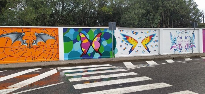
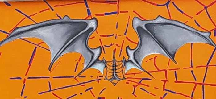
The graffiti was painted by the pupils in three weeks of work and are part of the project ‘Una Scuola grande come il mondo’ made in cooperation with the city council and the ministery of Art and Culture. It was finished in October 2021. The huge, colorful and beautiful graffiti gives dignity to the grey public walls and make the eyes of everyone walking or driving by turn.


PORTUGAL
A few words about us
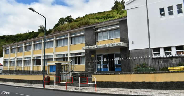
Escola Básica e Secundária da Povoação is an elementary and high school located in a village called Povoação.
Povoação is a county located in the Southeast part of São Miguel, the biggest Island of the Azores, an archipelago of nine islands in the Atlantic Ocean.
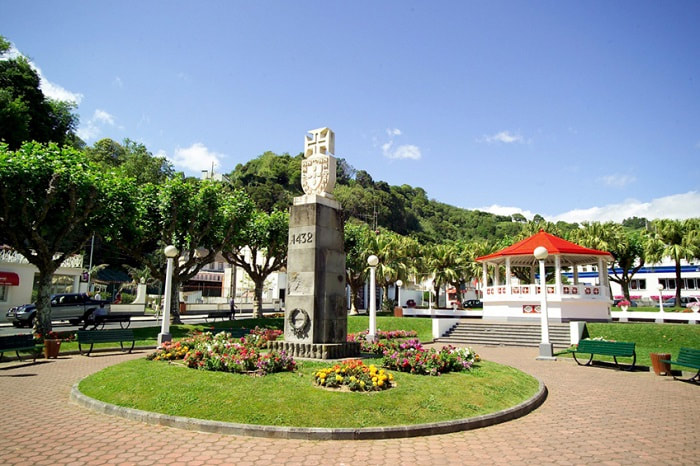
S. Miguel was the second of the nine Azorean islands discovered by the Portuguese, after Santa Maria, in 1427. The settlement did not take place right away. Gonçalo Velho Cabral gathered resources and settlers and started establishing colonies in 1432. Povoação was the first settlement of the islands and this explains its name, as Povoação means ‘village’. For some time, it was the only village.
Escola Básica e Secundária da Povoação is an elementary and high school located in a village called Povoação.
Povoação is a county located in the Southeast part of São Miguel, the biggest Island of the Azores, an archipelago of nine islands in the Atlantic Ocean.
S. Miguel was the second of the nine Azorean islands discovered by the Portuguese, after Santa Maria, in 1427. The settlement did not take place right away. Gonçalo Velho Cabral gathered resources and settlers and started establishing colonies in 1432. Povoação was the first settlement of the islands and this explains its name, as Povoação means ‘village’. For some time, it was the only village.
Our country
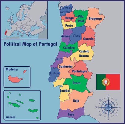
Portugal (or Portuguese Republic) is the westernmost sovereign state in mainland Europe, occupying an area of 92,345 km2. Our territory also includes the Atlantic archipelagos of the Azores and Madeira, both autonomous regions with their own regional governments. The population is around 10500000 people.
Administratively, Portugal is divided into 308 municipalities (Portuguese: municípios or concelhos), which are subdivided into 3,092 civil parishes (Portuguese: freguesias). Continental Portugal is agglomerated into 18 districts, while the archipelagos of the Azores and Madeira are governed as autonomous regions.
The 18 districts of mainland Portugal are: Aveiro, Beja, Braga, Bragança, Castelo Branco, Coimbra, Évora, Faro, Guarda, Leiria, Lisbon, Portalegre, Porto, Santarém, Setúbal, Viana do Castelo, Vila Real and Viseu – each district takes the name of the district capital.
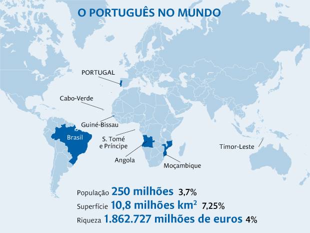
The Portuguese language is derived from the Latin spoken by the romanized pre-Roman peoples of the Iberian Peninsula around 2000 years ago. In the 15th and 16th centuries, the language spread worldwide as Portugal established a colonial and commercial empire between 1415 and 1999. Portuguese is spoken as a native language in five different continents, with Brazil accounting for the largest number of native Portuguese speakers of any country. The Portuguese language is the official language spoken in Brazil, Angola, Mozambique, Cape Verde, São Tomé and Príncipe, Guinea-Bissau, Equatorial Guinea, and East Timor. These countries, plus Macau Special Administrative Region (People's Republic of China) where Portuguese is co-official with Cantonese, make up the Lusosphere, a term derived from the ancient Roman province of "Lusitania", which currently matches the Portuguese territory south of the Douro river.
Portugal is the oldest nation state of the Iberian Peninsula and one of the oldest in Europe, its territory having been continuously settled, invaded and fought since prehistoric times. It was inhabited by pre-Celtic and Celtic peoples, visited by Phoenicians-Carthaginians, Ancient Greeks and ruled by the Romans, who were followed by the invasions of the Suebi and Visigothic Germanic peoples. After the Muslim conquest of the Iberian Peninsula, most of the territory was part of Al-Andalus. Portugal as a country was established during the early Christian Reconquista. Founded in 868, the County of Portugal gained prominence after the Battle of São Mamede (1128). The Kingdom of Portugal was later proclaimed following the Battle of Ourique (1139), and independence from León was recognized by the Treaty of Zamora (1143).
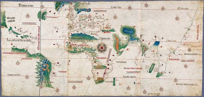
In the 15th and 16th centuries, Portugal established the first global maritime and commercial empire, becoming one of the world's major economic, political and military powers. During this period, today referred to as the Age of Discovery, Portuguese explorers pioneered maritime exploration with the discovery of what would become Brazil (1500). During this time Portugal monopolized the spice trade, divided the world into hemispheres of dominion with Castile, and the empire expanded with military campaigns in Asia. However, events such as the 1755 Lisbon earthquake, the country's occupation during the Napoleonic Wars, and the independence of Brazil (1822) erased to a great extent Portugal's prior opulence.
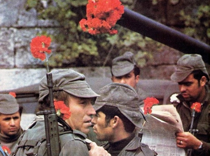
After the 1910 revolution deposed the monarchy, the democratic but unstable Portuguese First Republic was established, later being superseded by the Estado Novo authoritarian regime. Democracy was restored after the Carnation Revolution (1974), ending the Portuguese Colonial War. Shortly after, independence was granted to almost all overseas territories. The handover of Macau to China (1999) marked the end of what can be considered one of the longest-lived colonial empires in history.
After the 1910 revolution deposed the monarchy, the democratic but unstable Portuguese First Republic was established, later being superseded by the Estado Novo authoritarian regime. Democracy was restored after the Carnation Revolution (1974), ending the Portuguese Colonial War. Shortly after, independence was granted to almost all overseas territories. The handover of Macau to China (1999) marked the end of what can be considered one of the longest-lived colonial empires in history.
Portugal has left a profound cultural, architectural and linguistic influence across the globe, with a legacy of around 250 million Portuguese speakers, and many Portuguese-based creoles.
Our region
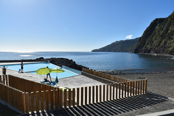
The Azores is an archipelago composed of nine volcanic islands in the Macaronesia region of the North Atlantic Ocean, about 1,400 km west of Lisbon in continental Portugal.
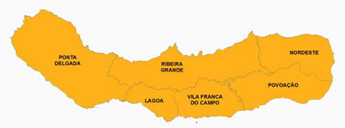
The main industries are agriculture, dairy farming, livestock, fishing, and tourism. The main city of the Azores is Ponta Delgada.
There are nine major Azorean islands and an islet cluster, in three main groups. These are Flores and Corvo, to the west; Graciosa, Terceira, São Jorge, Pico, and Faial in the centre; and São Miguel, Santa Maria, and the Formigas Reef to the east. They extend for more than 600 km and lie in a northwest–southeast direction.
Our region
The Azores is an archipelago composed of nine volcanic islands in the Macaronesia region of the North Atlantic Ocean, about 1,400 km west of Lisbon in continental Portugal.
The main industries are agriculture, dairy farming, livestock, fishing, and tourism. The main city of the Azores is Ponta Delgada.
There are nine major Azorean islands and an islet cluster, in three main groups. These are Flores and Corvo, to the west; Graciosa, Terceira, São Jorge, Pico, and Faial in the centre; and São Miguel, Santa Maria, and the Formigas Reef to the east. They extend for more than 600 km and lie in a northwest–southeast direction.
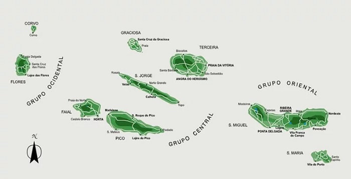
All the islands have volcanic origins, although some, such as Santa Maria, have had no recorded activity since the islands were settled several centuries ago. Mount Pico, on the island of Pico, is the highest point in Portugal, at 2,351 m. If measured from their base at the bottom of the ocean to their peaks, which thrust high above the surface of the Atlantic, the Azores are among the tallest mountains on the planet.
The climate of the Azores is very mild for such a northerly location, being influenced by its distance from the continents and by the passing Gulf Stream. Due to the marine influence, temperatures remain mild year-round. Daytime temperatures normally fluctuate between 16°C and 25°C depending on season. Temperatures above 30°C or below 3°C are unknown in the major population centres. It is also generally wet and cloudy.
The culture, dialect, cuisine, and traditions of the Azorean islands vary considerably, because these remote islands were settled sporadically over a span of two centuries.
São Miguel is the largest and most populous island in the the Azores. The island covers 760 km2 and has around 140,000 inhabitants, with 45,000 people residing in Ponta Delgada, the archipelago's largest city.
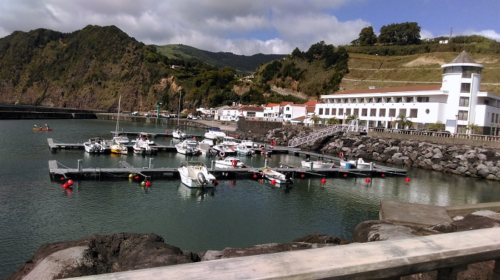
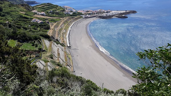
Povoação is one of the municipalities of S. Miguel, in the southeastern corner of the island, 60 km east of the regional capital, Ponta Delgada. The population is around 6000 inhabitants, in an area of 106.41 km².
The climate of the Azores is very mild for such a northerly location, being influenced by its distance from the continents and by the passing Gulf Stream. Due to the marine influence, temperatures remain mild year-round. Daytime temperatures normally fluctuate between 16°C and 25°C depending on season. Temperatures above 30°C or below 3°C are unknown in the major population centres. It is also generally wet and cloudy.
The culture, dialect, cuisine, and traditions of the Azorean islands vary considerably, because these remote islands were settled sporadically over a span of two centuries.
São Miguel is the largest and most populous island in the the Azores. The island covers 760 km2 and has around 140,000 inhabitants, with 45,000 people residing in Ponta Delgada, the archipelago's largest city.
Povoação is one of the municipalities of S. Miguel, in the southeastern corner of the island, 60 km east of the regional capital, Ponta Delgada. The population is around 6000 inhabitants, in an area of 106.41 km².
In 1432, Gonçalo Velho Cabral, then first Captain-Donatário of São Miguel, chose the locality for the first settlement on the island. From this location they began to transport cattle, wheat seeds, vegetables and agricultural implements in order to make the settlement viable.
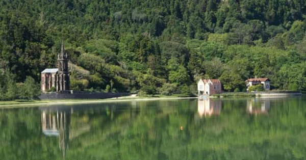
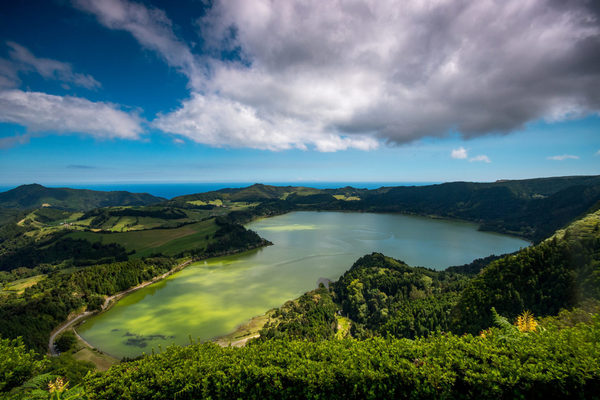
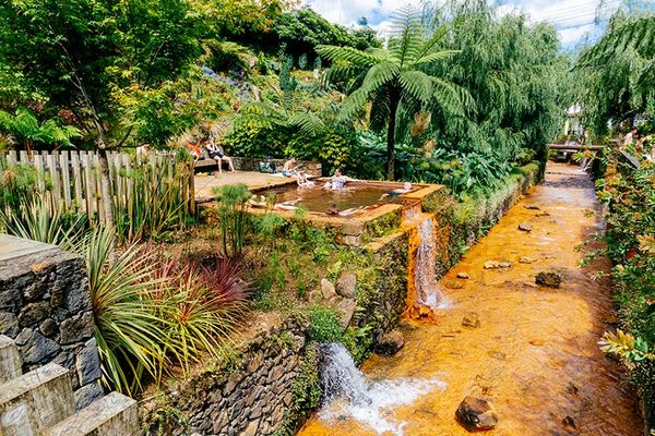
The municipality is sustained by the agriculture and fishing industries, with many of the businesses and commerce situated in the coastal urban center of Povoação. Tourism is also an important part of the regional activities with places like Furnas attracting naturalists and leisure activities.
The municipality is sustained by the agriculture and fishing industries, with many of the businesses and commerce situated in the coastal urban center of Povoação. Tourism is also an important part of the regional activities with places like Furnas attracting naturalists and leisure activities.
|
Our school
Our school was created in 1963, by private initiative. A priest called João de Medeiros asked permission to the Ministry of Education to create in Povoação a school that could teach higher levels than primary school. He invested his own money (he was the winner of an American lottery) and called the school Maria Isabel do Carmo Medeiros, in honor of his mother. |
In the 90’s, the Azorean government bought the building and made it a public school. Later, high school level was added and now it includes several buildings, being the original the main one. This one is still called Maria Isabel do Carmo Medeiros but the official name of the whole institution is Escola Básica e Secundária da Povoação.


FRANCE (Reunion)
Where is Reunion Island?
The best way is to click here to see the map!
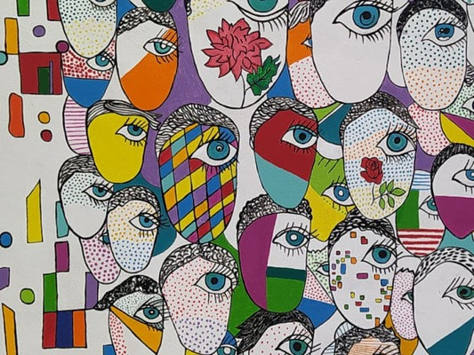
Diversity
Reunion mean "meeting" and our island is a great example of diversity living.
Have a look on this pdf to discover it.
The best way is to click here to see the map!
Diversity
Reunion mean "meeting" and our island is a great example of diversity living.
Have a look on this pdf to discover it.
| Reunion island-diversity |
A few words about our school
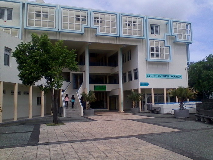
The name is "lycée Antoine Roussin" (Antoine Roussin Highschool).
The name is "lycée Antoine Roussin" (Antoine Roussin Highschool).
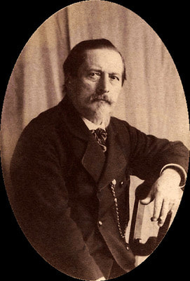
Antoine Roussin was a painter and photographer in the 19th century.
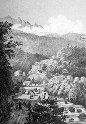
Lycée Antoine Roussin was created in 1960 and is located in the city of Saint-Louis, between Etang- Salé, a small resort along black sand beaches and Saint-Pierre, the capital city of the South with its beautiful lagoon. Our school hosts around 1200 students aged 15 to 20. It has a main building and a boarding area for students living in far away from home. What makes our school such a special place to teach at is the combination of the students' underprivileged social background and the determination and commitment of teachers to bring out the best in them as students and citizens. The school is located in a rural area (our students' grandparents often used to work at the sugar cane factory which has narrowed down its workforce since).

|
|
|
|
